Adresse
Fleckenweiher 3
41516 Grevenbroich
Germany
Koordinate
51.124821255134, 6.6627087982859
In the available sources there are no references to the exact date of the foundation of the old Jüdische cemetery in Hülchrath. A cadastral map from 1811 describes the plot as "Old Jüden Kirchhof". Due to the high groundwater level, the land was repeatedly flooded. 1900 at the end of today's Jahnstraße the new Jüdische cemetery was created, on which 1907 the first burial took place.
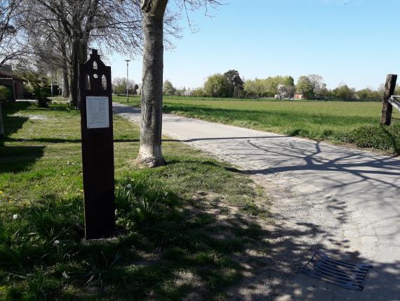
Während of the pogrom from 9 to 10 November 1938 were both Friedhöfe geschändet. Afterwards, students of the so-called Reichsbauernschule, which was located in Hülchrather Schloss, removed the gravestones that remained in the old cemetery. Until 1987 the gravestones were stored in the outer castle. Today the plot is no longer recognizable as a cemetery, because there are no gravestones left there. A stele erected by the village community Hülchrath opposite the plot reminds of its former use. Here is also the cadastral map of 1811 depicted.
.
Ereignisse
Beschreibung
in a cadastral map from 1811 there is an entry "Alter Jüden Kirchhof" (old Jewish churchyard) at the plot of land
Epoche universalgeschichtlich
Beschreibung
November Pogrom
Epoche universalgeschichtlich
Beschreibung
Removal of the remaining gravestones by students of the so-called Reichsbauernschule after the pogrom.
Epoche universalgeschichtlich
Beschreibung
The tombstone fragments are stored in the Hülchrath outer castle
Epoche universalgeschichtlich
Beschreibung
Installation of a stele with information about the old Jewish cemetery across the street from the property.
Epoche universalgeschichtlich
Literatur
Pracht-Jörns, E.: Jüdisches Kulturerbe in Nordrhein-Westfalen: Teil II: Regierungsbezirk Düsseldorf; J.P. Bachem Verlag, Köln, 2000.
Frinken, A.: Keine Blumen, sondern Steine: Die jüdischen Friedhöfe in Hemmerden, Hülchrath und Wevelinghoven als Gedenkorte in dörflichen, niederrheinischen Kontexten; Köln, 2022 (Masterarbeit).
Redaktionell überprüft
Aus

Add new comment