Complete profile
90
Kategorie
Adresse
Schulweg
16303 Schwedt/Oder
Germany
Koordinate
53.064427129459, 14.286249134553
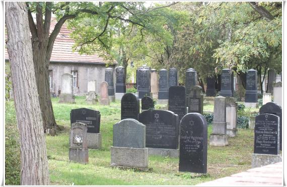
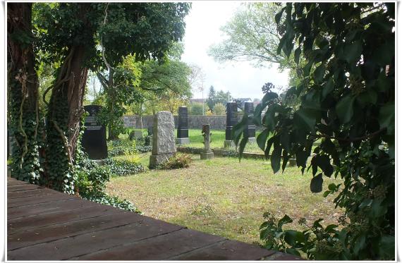
The first cemetery was established in the 17th century, the new cemetery was established in 1850. It includes 121 gravestones and was not destroyed during the Nazi period.
The cemetery is located in western direction not far from the train station, north of the tracks, at the corner of Helbigstraße and Schulweg.
Ereignisse
Ereignis
Datum Von
1600-01-01
Datum bis
1699-12-31
Datierung
17. Jahrhundert
Epoche universalgeschichtlich
Beschreibung
last funeral
Ereignis
Datum Von
1938-01-01
Datum bis
1942-12-31
Datierung
1942
Epoche universalgeschichtlich
Beschreibung
secret burial, tombstone 1945
Ereignis
Datum Von
1942-01-01
Datum bis
1942-12-31
Datierung
1942
Epoche universalgeschichtlich
Beschreibung
Return of the cemetery to the Association of Jewish Communities in the GDR
Ereignis
Datum Von
1950-01-01
Datum bis
1950-12-31
Datierung
1950
Epoche universalgeschichtlich
Medien
Auf dem Friedhof in Schwedt

Aufnahmedatum
2007
Fotografiert von
Dr. Hans-Peter Laqueur
wheumann
Bildquelle (Woher stammt das Bild)
Eigenes Bild
Breite
2388
Höhe
1564
Lizenz
CC BY-SA 4.0
Beschreibung
A view of some tombstones, in the background probably the Tahara Hall
Mimetype
image/jpeg
Blick auf den Friedhof von Schwedt

Aufnahmedatum
2007
Fotografiert von
Dr. Hans-Peter Laqueur
wheumann
Bildquelle (Woher stammt das Bild)
Eigenes Foto
Breite
2388
Höhe
1564
Lizenz
CC BY-SA 4.0
Beschreibung
View of the cemetery with some gravestones
Mimetype
image/jpeg
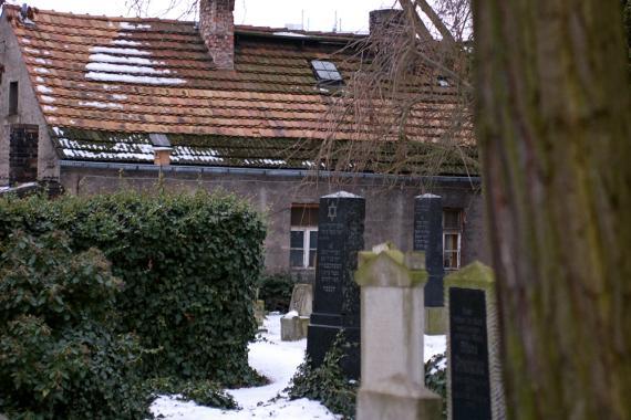
Grabsteine, im Hintergrund das ehemalige Totengräberhaus

Aufnahmedatum
2009-12
Fotografiert von
Catfisheye
Charlotte
Bildquelle (Woher stammt das Bild)
Eigenes Werk
Breite
570
Höhe
380
Lizenz
CC BY-SA 3.0
Beschreibung
Gravestones, in the background the former gravedigger's house
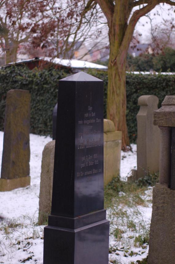
Ein 2,40 m hoher Grabstein. Diese Seite zeigt die deutsche Inschrift

Aufnahmedatum
2009-12
Fotografiert von
Catfisheye
Charlotte
Bildquelle (Woher stammt das Bild)
Eigenes Werk
Breite
570
Höhe
857
Lizenz
CC BY-SA 3.0
Beschreibung
A 2.40 m high gravestone. This side shows the German inscription
Weiterführender Link
Redaktionell überprüft
Aus
Partner Term
Add new comment