Complete profile
90
Kategorie
Adresse
Hofmannstraße
97084 Heidingsfeld
Germany
Koordinate
49.76384795, 9.9432867070452
The Jewish cemetery in Heidingsfeld was established and first occupied in 1811. Until 1881 Würzburg Jews were also buried there. The last burials were in Heidingsfeld in 1942. The cemetery area covers 56.60 ar. The cemetery is divided into a large old and a newer part and is surrounded by a massive stone wall. The last gravestones (1930-1942) are located on the wall opposite the entrance. From the present entrance gate, the terrain rises steeply. A small tahara hut stands to the left of the entrance.
.Medien
Heidingsfeld Friedhof CAHJP
Fotografiert von
Central Archives for the History of the Jewish People, Jerusalem
admin
Breite
695
Höhe
518
Lizenz
cc by-sa 4.0
Beschreibung
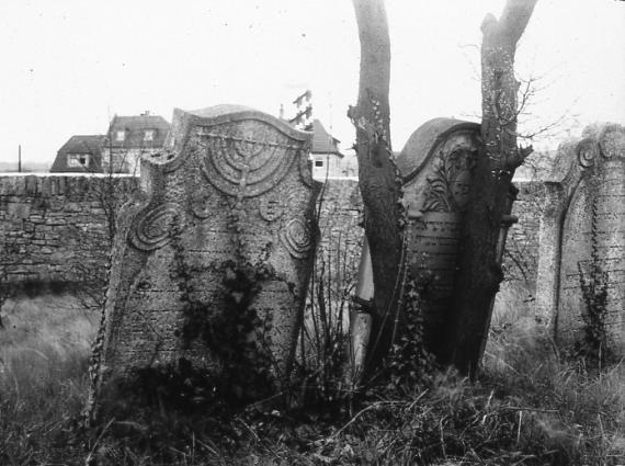
Heidingsfeld, Jewish cemetery: gravestones from 1814, shell limestone (Theodor Harburger 1927).
Partner
Haus der Bayrischen Geschichte
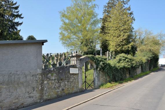
Der verschlossene Eingangsbereich
Aufnahmedatum
2017-04-21 10:36:32
Fotografiert von
--Nightflyer (Diskussion) 18:31, 27 April 2017 (UTC)
Import
Bildquelle (Woher stammt das Bild)
Eigenes Werk
Breite
2048
Höhe
1365
Lizenzhinweise
Creative Commons Attribution 4.0
Lizenz
CC BY 4.0
Beschreibung
Impressions of the Jewish cemetery in Heidingsfeld (Würzburg).
The cemetery was closed and not accessible, paths were not recognizable.
The cemetery was closed and not accessible, paths were not recognizable.
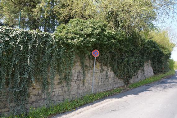
Friedhofsmauer
Aufnahmedatum
2017-04-21 10:36:04
Fotografiert von
--Nightflyer (Diskussion) 18:21, 27 April 2017 (UTC)
Import
Bildquelle (Woher stammt das Bild)
Eigenes Werk
Breite
2048
Höhe
1365
Lizenzhinweise
Creative Commons Attribution 4.0
Lizenz
CC BY 4.0
Beschreibung
Impressions of the Jewish cemetery in Heidingsfeld (Würzburg).
The cemetery was closed and not accessible, paths were not recognizable.
The cemetery was closed and not accessible, paths were not recognizable.
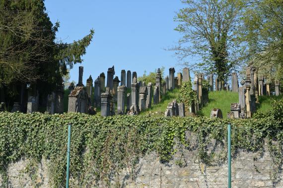
Blick über die Mauer
Aufnahmedatum
2017-04-21 10:38:40
Fotografiert von
--Nightflyer (Diskussion) 18:40, 27 April 2017 (UTC)
Import
Bildquelle (Woher stammt das Bild)
Eigenes Werk
Breite
2048
Höhe
1365
Lizenzhinweise
Creative Commons Attribution 4.0
Lizenz
CC BY 4.0
Beschreibung
Impressions of the Jewish cemetery in Heidingsfeld (Würzburg).
The cemetery was closed and not accessible, paths were not recognizable.
The cemetery was closed and not accessible, paths were not recognizable.
Partner Link
Redaktionell überprüft
Aus
Leichte Sprache
Aus
Partner Term
Add new comment