Complete profile
100
Kategorie
Adresse
Dybowska 11
11-730 Miasto Mikołajki
Poland
Koordinate
53.796122722796, 21.583821420889
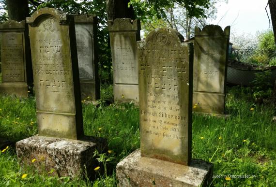
The cemetery served the Jewish community of the East Prussian village of Nikolajken. The region belonged to the German Reich until 1945. Mixed inscriptions, in Hebrew and German, are most common. The Hebrew version was often engraved on the front of the gravestone, while the German version is on the back, or the Hebrew version is on the upper part and the German version is on the lower part of the matzeva (gravestones). The cemetery must have been devastated both before and after 1945, but it is still one of the best preserved Jewish cemeteries in the Masuria. It is easily accessible by car and in a well-maintained condition.
Ereignisse
Beschreibung
according to the year on the oldest known gravestone
Ereignis
Datum Von
-0500-01-01
Datum bis
1847-12-31
Datierung
vor 1848
Epoche universalgeschichtlich
Beschreibung
Latest known year on a tombstone, in the 30s.
Ereignis
Datum Von
1931-01-01
Datum bis
1931-12-31
Datierung
1931
Epoche universalgeschichtlich
Medien
Friedhof Mikolajki

Aufnahmedatum
11.05.2016
Fotografiert von
Michael Leiserowitz
Leiserowitz
Bildquelle (Woher stammt das Bild)
Juden in Ostpreussen e.V.
Breite
1024
Höhe
695
Lizenz
CC BY-SA 4.0
Beschreibung
Gravestones of the Jewish cemetery of the Jewish community of Nikolaik
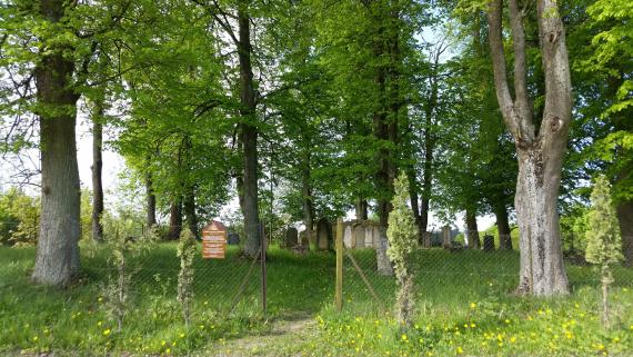
Eingang des Jüdischen Friedhofs Mikolajki

Aufnahmedatum
11.05.2016
Fotografiert von
Michael Leiserowitz
Leiserowitz
Bildquelle (Woher stammt das Bild)
Juden in Ostpressen e.V.
Breite
5312
Höhe
2988
Lizenz
CC BY-SA 4.0
Beschreibung
Entrance of the Jewish Cemetery Mikolajki
Friedhof Mikolajken
Aufnahmedatum
11.05.2016
Fotografiert von
Michael Leiserowitz
Leiserowitz
Bildquelle (Woher stammt das Bild)
Juden in Ostpressen e.V.
Breite
2048
Höhe
1536
Lizenz
CC BY-SA 4.0
Beschreibung
The cemetery of Mikolajki seen from the street.
Weiterführender Link
Redaktionell überprüft
Aus
Leichte Sprache
Aus
Partner Term
Add new comment