Complete profile
80
Kategorie
Adresse
Dominikanergasse 2
60311 Frankfurt am Main
Germany
Früherer Straßenname
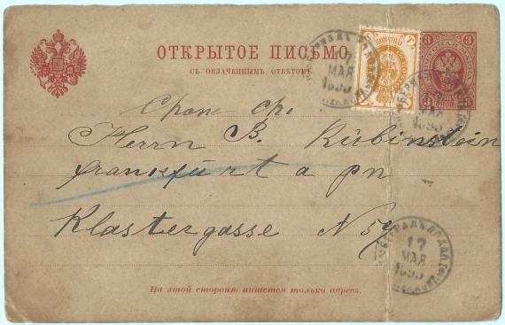
Klostergasse 59
Koordinate
50.112045382921, 8.6865692674302
According to the Ravenstein plan of 1861, the house Klostergasse 59 was located exactly opposite the exit of the street " Am Judenbrückchen ". In 1937, during the redevelopment of Frankfurt's Old Town, the houses in the northern part of Klostergasse were demolished. In 1944, during an air raid in 1944, the area around the Klostergasse was völlig destroyed.
Medien
Postkarte - B.Rubinstein

Aufnahmedatum
1895
Fotografiert von
Peter Karl Müller, Kirchheim am Ries
PKM
Bildquelle (Woher stammt das Bild)
Eigene Sammlung
Breite
3428
Höhe
2207
Lizenz
CC BY-SA 4.0
Beschreibung
Postcard from Russia to Mr. B. Rubinstein, Frankfurt am Main, Klostergasse No. 59, - mailed on March 17, 1895
Mimetype
image/jpeg
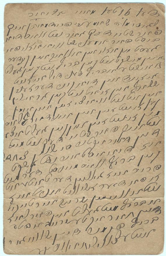
Postkarte - B. Rubinstein

Aufnahmedatum
1895
Fotografiert von
Peter Karl Müller, Kirchheim am Ries
PKM
Bildquelle (Woher stammt das Bild)
Eigene Sammlung
Breite
2225
Höhe
3427
Lizenz
CC BY-SA 4.0
Beschreibung
Postcard from Russia to Mr. B. Rubinstein, Frankfurt am Main, Klostergasse No. 59, - mailed March 17, 1895 - back of card - written in Hebrew - possibly Yiddish
Mimetype
image/jpeg
Weiterführender Link
Redaktionell überprüft
Aus
Add new comment