Nordstraße
63450 Hanau
Germany
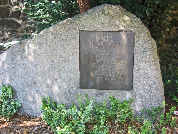
Against the former location of the synagogue, there has been a memorial stone since 1964, which commemorates the expelled Jewish community. It is accompanied by a plaque that gives explanations about the historical background. Behind this memorial are wall remains of the „Hexen-“ or „Diebsturm“, part of the medieval fortifications of the old town of Hanau. In 1605–1608, this tower housed the first temporary synagogue of the community.
The memorial site for the former Jewish synagogue is located in a small green area on the edge of Nordstraße in downtown Hanau. It can be reached from Freiheitsplatz with a few steps.
The green area is located directly in front of the remains of the old city fortifications of Hanau. On the other side of the street was the synagogue, which was burned during the pogrom night in November 1938.


Add new comment