Complete profile
100
Kategorie
Adresse
Dwarsefeld
46419 Isselburg
Germany
Koordinate
51.865876562827, 6.3992766744022
Since the early 17th century, Jewish families can be traced in Anholt, a small town on the Lower Rhine.
A synagogue in the town was consecrated in 1831. It fell victim to the war.
At the beginning of the 20th century, the Jewish community disappeared due to emigration from Anholt.
The cemetery at the Dwarsefeld was used from the beginning of the 19th century. The last burial took place in 1934.
Today there are still 17 gravestones on the site
.Ereignisse
Ereignis
Datum Von
1820-01-01
Datum bis
1820-12-31
Datierung
1820
Epoche universalgeschichtlich
Medien
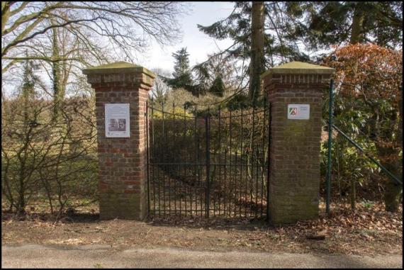
Friedhofstor von Anholt

Aufnahmedatum
2016
Fotografiert von
Dr. Wolfgang Heumann
wheumann
Bildquelle (Woher stammt das Bild)
Eigenes Werk
Breite
1024
Höhe
685
Lizenz
CC BY-SA 4.0
Beschreibung
The massive cemetery gate in front of the cemetery
Mimetype
image/jpeg
Überblick über den Friedhof

Aufnahmedatum
2016
Fotografiert von
Dr. Wolfgang Heumann
wheumann
Bildquelle (Woher stammt das Bild)
Eigenes Werk
Breite
1024
Höhe
576
Lizenz
CC BY-SA 4.0
Beschreibung
A view over the cemetery
Mimetype
image/jpeg
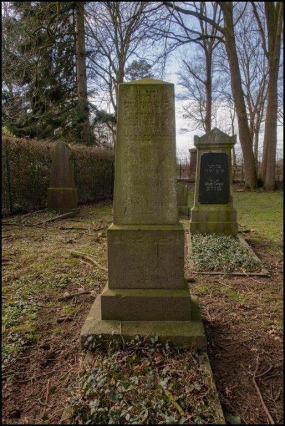
Einzelner grosser Grabstein

Aufnahmedatum
2016
Fotografiert von
Dr. Wolfgang Heumann
wheumann
Bildquelle (Woher stammt das Bild)
Eigenes Werk
Breite
514
Höhe
768
Lizenz
CC BY-SA 4.0
Beschreibung
Single large , pillar gravestone
Mimetype
image/jpeg
Weiterführender Link
Literatur
Pracht Jörns, Elfi, Jüdisches Kulturerbe, Bachem, Köln, Band IV, 2002
www.uni-heidelberg.de/institute/sonst/aj/FRIEDHOF/NRW/PROJEKTE/titel.htm
www.alemannia-judaica.de
Redaktionell überprüft
Aus
Partner Term
Add new comment