Complete profile
100
Kategorie
Adresse
Siedlungsweg 13
16269 Wriezen
Germany
Koordinate
52.726895930882, 14.126538737321
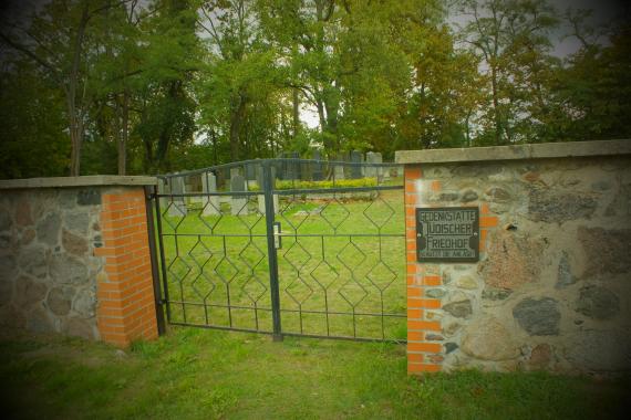
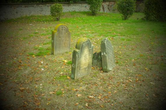
A burial ground had already been acquired in 1730, the oldest legible grave inscription there is from 1783, the last burial took place in 1940. In the Nazi period, but also in recent times,the cemetery was devastated, after 1990 a fundamental restoration took place.
Coming from Bad Freienwalde (B167), one sees soon after entering the village on the right a gas station. A few meters after that you turn left into Kastanienweg, and at the first opportunity left again into Siedlungsweg, at the end of which is the cemetery.
Ereignisse
Beschreibung
The cemetery was occupied from 1730 to 1940
Ereignis
Datum Von
1730-01-01
Datum bis
1730-12-31
Datierung
1730
Epoche universalgeschichtlich
Medien
Eingang zum Friedhof in Wriezen

Aufnahmedatum
10-2019
Fotografiert von
Dr. Hans-Peter Laqueur
wheumann
Bildquelle (Woher stammt das Bild)
Eigene Aufnahme
Breite
2304
Höhe
1536
Lizenz
CC BY-SA 4.0
Beschreibung
You can see the Einag gate to one of the most beautiful preserved cemeteries in Brandenburg
Mimetype
image/jpeg
Grabsteine auf dem Friedhof Wriezen

Aufnahmedatum
10-2019
Fotografiert von
Dr. Hans-Peter Laqueur
wheumann
Bildquelle (Woher stammt das Bild)
Eigene Aufnahme
Breite
2304
Höhe
1536
Lizenz
CC BY-SA 4.0
Beschreibung
Single gravestones at the cemetery Wriezen
Mimetype
image/jpeg
Weiterführender Link
Literatur
http://www.jüdische-gemeinden.de/index.php/gemeinden/u-z/2135-wriezen-oder-brandenburg (letzter Zugriff am 04.11.19)
http://www.chewrakadischa-blb.de/Judische-Friedhofe/Landkreis-Markisch---Oderland/landkreis-markisch---oderland.html (letzter Zugriff am 04.11.19)
https://www.uni-potsdam.de/de/juedische-friedhoefe/friedhof-wriezen/geschichte-der-gemeinde.html (letzter Zugriff am 04.11.19)
Redaktionell überprüft
Aus
Partner Term
Add new comment