Puschkinallee 18
14469 Potsdam
Germany
The Jewish cemetery Potsdam in the Puschkinallee 18 was created in 1743 on today's Pfingstberg. The oldest and at the same time only grave from the founding year of the cemetery belongs to Mrs. Edel, who died on 24.02.1743.
In most of the gravestones the inscription is in Hebrew. In addition, you can see there various symbols and decorations: The typical blessing sign (two hands touching) means that the men buried there consider themselves members of the Kohanim (priests) group. There are also crowns, which can often be interpreted as the sun. They are characteristic for the cemetery in Potsdam. The crown has 3 meanings in the tradition, as a crown of the good name, as a crown of the Torah and as a crown of the priesthood. The symbol of the pitcher, which is seen on some tombstones, means that the deceased is descended from the Levites (servants of the Jerusalem Temple). The Star of David was originally a magical sign and purely decorative. He became the symbol of Judaism only in the 19th century.
On Dec. 29, 1855, the Holy Brotherhood "Chewra Kaddisha" was reestablished as an association in Potsdam. According to Jewish law and ritual, only members of the association are allowed to perform funerals. They accompany the dying and care for the relatives. In the mourning hall, which was expanded in 1910, the deceased are washed and dressed, and the members of the funeral brotherhoods accompany the funeral service. Since the reestablishment of the Jewish community in 1991, over 50 members have found their resting place here.
In the mourning hall is a memorial plaque commemorating German Jewish soldiers who died in World War I. The plaque is also a memorial to the Jewish community. Jews who were expelled from Potsdam between 1933 and 1943 or did not survive deportation to the death camps are commemorated by a large memorial stone in the IV burial section.
In 1999, the Jewish cemetery was recognized as a UNESCO World Heritage Site.


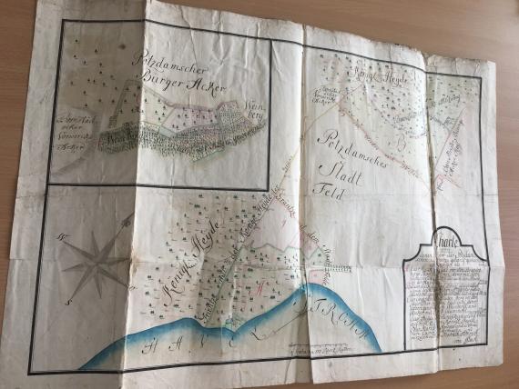
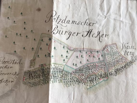
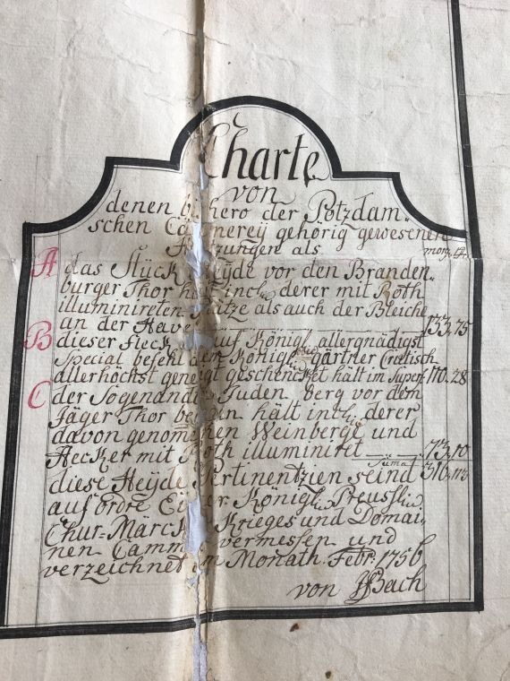
Request of the sculptor Angermann for the transfer of land on the so-called Schraderberg near Potsdam for the establishment of a mulberry plantation. Contains, among other things, map with "Jewish burial ground," 1756
Request of the sculptor Angermann for the transfer of land on the so-called Schraderberg near Potsdam for the establishment of a mulberry plantation. Contains, among other things, map with "Jewish burial ground," 1756
Request of the sculptor Angermann for the transfer of land on the so-called Schraderberg near Potsdam for the establishment of a mulberry plantation. Contains, among other things, map with "Jewish burial ground," 1756
Add new comment