Complete profile
100
Kategorie
Adresse
Altenbergstraße 27
54329 Oberemmel
Germany
Koordinate
49.659122104913, 6.6341450650866
In the second half of the 19th century a synagogue was built, also the small cemetery was probably created around this time.
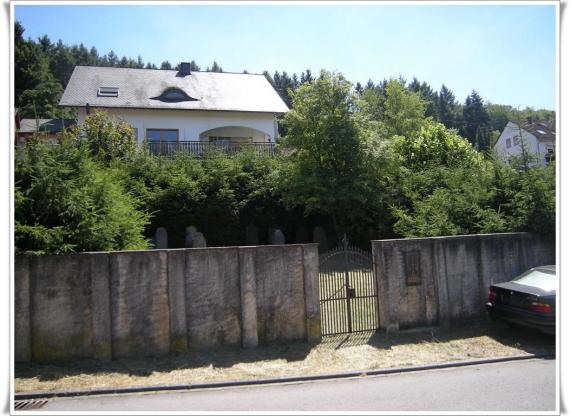
.Against the house Altenbergstr. 27. Coming from Konz, follow the L 138 through the village, and turn left behind the Aktiv-Markt into the Altenbergstraße (sign). The cemetery is enclosed by a wall, but through the closed gate completely visible.
.There are 12 graves from the first decades of the 20th century.
The cemetery is well kept
.As of July 2010.
Ereignisse
Beschreibung
Probably first documented in the 2nd half of the 19th century.
Ereignis
Datum Von
1899-01-01
Datum bis
1998-12-31
Datierung
2. Hälfte 19. Jahrhundert
Epoche universalgeschichtlich
Medien
Der Eingang zum Friedhof von Oberemmel
Aufnahmedatum
2010
Fotografiert von
Dr. Hans-Peter Laqueur
wheumann
Bildquelle (Woher stammt das Bild)
Eigenes Werk
Breite
1053
Höhe
768
Lizenz
CC BY-SA 4.0
Beschreibung
The photo shows the entrance gate of the cemetery.
Mimetype
image/jpeg
Weiterführender Link
Literatur
http://www.jüdische-gemeinden.de/index.php/gemeinden/m-o/1483-oberemmel-rheinland-pfalz
http://www.alemannia-judaica.de/oberemmel_synagoge.htm
Partner Link
Redaktionell überprüft
Aus
Add new comment