Complete profile
100
Kategorie
Adresse
Berliner Str. 12
16798 Fürstenberg/Havel
Germany
Koordinate
53.178205441712, 13.144170744749
Cemetery grounds without grave stock as a memorial.
Ereignisse
Beschreibung
The Jewish community in Fürstenberg successfully calls for the establishment of a cemetery at the
Ereignis
Datum Von
1761-01-01
Datum bis
1761-12-31
Datierung
1761
Epoche universalgeschichtlich
Beschreibung
Expansion of the cemetery and construction of a mortuary.
Ereignis
Datum Von
1793-01-01
Datum bis
1793-12-31
Datierung
1793
Epoche universalgeschichtlich
Beschreibung
Extensive renovation and construction of a brick wall around the cemetery.
Ereignis
Datum Von
1835-01-01
Datum bis
1835-12-31
Datierung
1835
Epoche universalgeschichtlich
Beschreibung
Repair of the wall and construction of a new mortuary.
Ereignis
Datum Von
1856-01-01
Datum bis
1856-12-31
Datierung
1856
Epoche universalgeschichtlich
Beschreibung
Last funeral
Ereignis
Datum Von
1925-01-01
Datum bis
1925-12-31
Datierung
1925
Epoche universalgeschichtlich
Medien
Gedenkstein jüdischer Friedhof Fürstenberg/Havel

Aufnahmedatum
21. Juni 2024
Fotografiert von
Emma Döllefeld
emmapdmsc
Bildquelle (Woher stammt das Bild)
Eigenaufnahme
Breite
3024
Höhe
4032
Lizenz
CC BY-SA 4.0
Beschreibung
In the picture you can see the memorial stone for the former Jewish cemetery. The remains of the Wall can also be seen in the background of the picture. It stands on Berliner Straße.
Lageplan
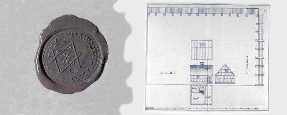
Aufnahmedatum
1856
Fotografiert von
Universität Potsdam
emmapdmsc
Bildquelle (Woher stammt das Bild)
Universität Potsdam
ggf. URL
https://www.uni-potsdam.de/de/juedische-friedhoefe/friedhof-fuerstenberghavel/geschichte-des-friedhofs
Breite
870
Höhe
349
Lizenz
CC BY-SA 4.0
Weiterführender Link
Literatur
_Fürstenberg/ Havel Ravensbrück, Beiträge zur Kulturgeschichte einer Region zwischen
Brandenburg
und Mecklenburg*: Band 1; Hentrich & Hentrich:
Wolfgang Stegemann; 1999
Brandenburg
und Mecklenburg*: Band 1; Hentrich & Hentrich:
Wolfgang Stegemann; 1999
http://www.juden-in-mecklenburg.de/Orte/
https://www.fuerstenberg-havel.de/buergerservice/friedhoefe
Redaktionell überprüft
Aus
Add new comment