Complete profile
90
Kategorie
Adresse
Bergstraße 5
17109 Demmin
Germany
Koordinate
53.903299408254, 13.051419181588
Enclosed cemetery with gravestone inventory. 34 gravestones.
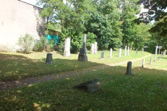
The well-kept cemetery is located at Bergstraße 5, not far behind the railroad tracks, it is partly walled and separated from the neighboring plot by a lattice fence, the gateposts with an inscription are preserved. The wooden gate is not locked, but it is very warped, so that it is difficult to open. Many of the tombstones (re)erected in rows show traces of vandalism.
Ereignisse
Beschreibung
End of use ca. 1933
Ereignis
Datum Von
1847-01-01
Datum bis
1847-12-31
Datierung
1847
Epoche universalgeschichtlich
Medien
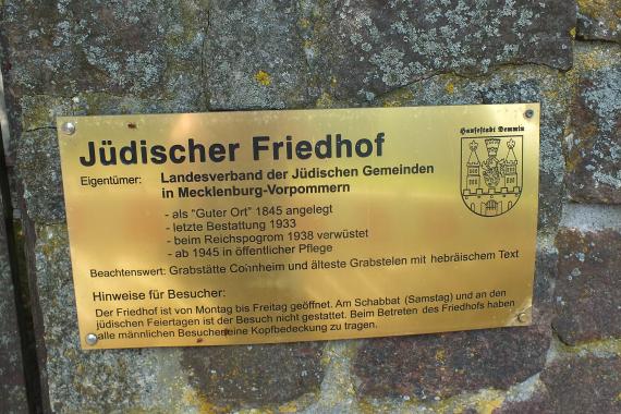
Hinweistafel am Friedhof von Demmin

Aufnahmedatum
2020
Fotografiert von
Dr. Hans-Peter Laqueur
wheumann
Bildquelle (Woher stammt das Bild)
Eigenes Bild
Breite
2304
Höhe
1536
Lizenz
CC BY-SA 4.0
Beschreibung
Information board at the cemetery of Demmin
Mimetype
image/jpeg
Blick auf den Friedhof

Aufnahmedatum
2020
Fotografiert von
Dr. Hans-Peter Laqueur
wheumann
Bildquelle (Woher stammt das Bild)
Eigenes Bild
Breite
2304
Höhe
1536
Lizenz
CC BY-SA 4.0
Beschreibung
View of the cemetery
Mimetype
image/jpeg
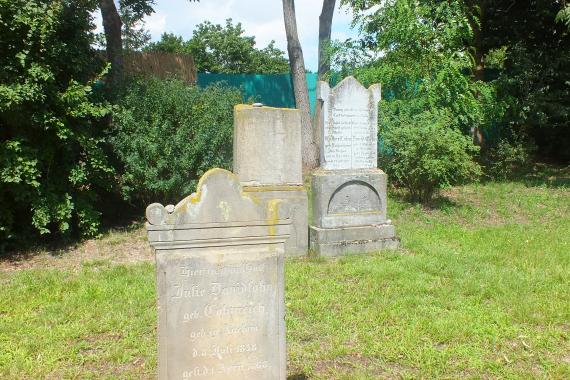
Einzelne Grabsteine auf dem Friedhof.

Aufnahmedatum
2020
Fotografiert von
Dr. Hans-Peter Laqueur
wheumann
Bildquelle (Woher stammt das Bild)
Eigenes Bild
Breite
2304
Höhe
1536
Lizenz
CC BY-SA 4.0
Beschreibung
Single gravestones in the cemetery.
Mimetype
image/jpeg
Weiterführender Link
Literatur
http://www.alemannia-judaica.de/demmin_friedhof.htm
Brocke/Ruthenberg/Schulenburg, Stein und Name. Die jüdischen Friedhöfe in Ostdeutschland. Berlin 1994, 294-295.
https://www.jüdische-gemeinden.de/index.php/gemeinden/c-d/117-demmin-mecklenburg-vorpommern
Redaktionell überprüft
Aus
Add new comment