Complete profile
80
Kategorie
Adresse
Schützenstraße 31
19386 Lübz
Germany
Früherer Straßenname
Werner-Seelenbinder-Straße
Koordinate
53.45912795, 12.0432498
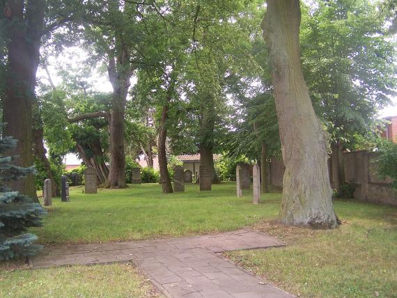
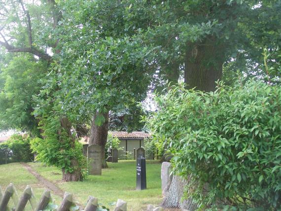
The Jewish cemetery in Lübz was possibly established in the 18th century. The oldest preserved stone is from 1839, the youngest from 1924. The cemetery is said to have been occupied until 1934. The cemetery passed (already in 1916?) to the city. It was not destroyed during the Nazi period. The area of the cemetery is about 7.80 ares. Today there are still about 20 gravestones left, which were laid flat on the lawn in 1989.
Medien
Blick vom Haupteingang
Aufnahmedatum
2011-06-26
Fotografiert von
Matthias Apsel
admin
Bildquelle (Woher stammt das Bild)
Matthias Apsel
ggf. URL
https://de.wikipedia.org/wiki/J%C3%BCdischer_Friedhof_(L%C3%BCbz)#/media/File:J%C3%BCdischer_Friedhof_L%C3%BCbz.jpg
Breite
220
Höhe
165
Lizenzhinweise
Creative Commons Attribution 3.0
Lizenz
CC BY 3.0
Mimetype
image/jpeg
Verwendungshinweise
Ich, der Urheber dieses Werkes, veröffentliche es unter der folgenden Lizenz:
Blick von der Seite
Aufnahmedatum
2011-06-26
Fotografiert von
Matthias Apsel
admin
Bildquelle (Woher stammt das Bild)
Matthias Apsel
ggf. URL
https://de.wikipedia.org/wiki/J%C3%BCdischer_Friedhof_(L%C3%BCbz)#/media/File:J%C3%BCdischer_Friedhof_L%C3%BCbz_2.jpg
Breite
220
Höhe
165
Lizenzhinweise
Creative Commons Attribution 3.0
Lizenz
CC BY 3.0
Mimetype
image/jpeg
Verwendungshinweise
Ich, der Urheber dieses Werkes, veröffentliche es unter der folgenden Lizenz:
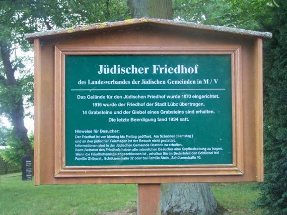
Infotafel am Friedhof
Aufnahmedatum
26.06.2011
admin
Bildquelle (Woher stammt das Bild)
Wikimedia Commons
ggf. URL
https://de.wikipedia.org/wiki/J%C3%BCdischer_Friedhof_(L%C3%BCbz)#/media/File:J%C3%BCdischer_Friedhof_L%C3%BCbz_Infotafel.jpg
Breite
220
Höhe
165
Lizenz
CC-BY-SA 3.0
Mimetype
image/jpeg
Weiterführender Link
Literatur
Zeugnisse jüdischer Kultur S. 38; Brocke/Ruthenberg/Schulenburg S. 484.
Partner Link
Redaktionell überprüft
Aus
Leichte Sprache
An
Partner Term
Add new comment