Complete profile
90
Kategorie
Adresse
Plattenstraße
41189 Wanlo
Germany
Koordinate
51.0967121, 6.4133444
Wanlo is the southernmost district of Mönchengladbach and belongs to the district of Mönchengladbach West, until October 22, 2009 the district of Wickrath. It is located southwest of the Mönchengladbach-Wanlo interchange, where the federal highways 46 and 61 intersect. Thus, Wanlo is separated from the rest of the city by the A 46. Wickrathberg lies to the north of the freeway. To the east lies the Jüchen district of Hochneukirch and to the south the Erkelenz villages of Keyenberg, Kuckum and Borschemich. As the latter give way to the Garzweiler open pit mine, Wanlo will lie on the edge of the open pit mine in a few decades.
The name Wanlo is derived from the union of the syllables Wan and lo. Wan means tub, hollow or body of water and stands for the Niers, which rises in nearby Kuckum and flows through Wanlo. Lo or Loh means light forest.
The name Wanlo is derived from the union of the syllables Wan and lo. Wan means tub, hollow or body of water and stands for the Niers, which rises in nearby Kuckum and flows through Wanlo. Lo or Loh means light forest.
Medien
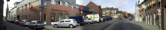
vergrößern und Informationen zum Bild anzeigenOrtskern von Wanlo

admin
Breite
600
Höhe
110
Mimetype
image/jpeg
Wanlo
Aufnahmedatum
2006-06
Fotografiert von
User Bodoklecksel on de.wikipedia
Import
Bildquelle (Woher stammt das Bild)
eigenes Foto, Fotograf/Zeichner: bodoklecksel
Breite
2048
Höhe
375
Lizenzhinweise
Creative Commons Attribution-Share Alike 3.0
Lizenz
CC BY-SA 3.0
Beschreibung
Panoramic montage Wanlo
Partner Link
Redaktionell überprüft
Aus
Partner Term
Add new comment