Complete profile
90
Kategorie
Adresse
Waldstraße
67292 Kirchheimbolanden
Germany
Koordinate
49.6669586, 7.9906507
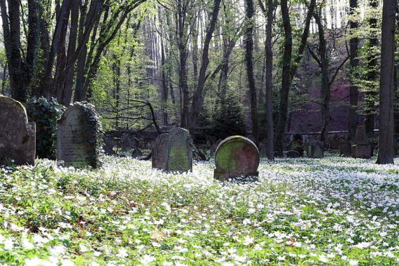
The cemetery was opened in 1843 (parcel 3070). Other sources mention this date only as an extension of the cemetery already established in the 17th century. The area covers 42.60 ares. A mortuary (Tahara house) was present. It was destroyed during the Nazi period and is only preserved as a ruin. There are still about 200 gravestones in the cemetery today.
A key to visit the cemetery can be obtained at the Kirchheimbolanden town hall. The cemetery is not accessible by car.
Medien
Der jüdische Waldfriedhof im „Judental“ bei Kirchheimbolanden
Aufnahmedatum
07.04.2011
Fotografiert von
PhilEOS
admin
Bildquelle (Woher stammt das Bild)
Wikimedia Commons
Breite
220
Höhe
147
Lizenz
CC-BY-SA-3.0
Mimetype
image/jpeg
Literatur
http://www.alemannia-judaica.de/kirchheimbolanden_friedhof.htm (letzter Zugriff am 02.07.18)
http://www.xn--jdische-gemeinden-22b.de/index.php/gemeinden/k-l/1054-kirchheimbolanden-rheienland-pfalz (letzter Zugriff am 02.07.18)
https://de.wikipedia.org/wiki/J%C3%BCdischer_Friedhof_(Kirchheimbolanden) (letzter Zugriff am 02.07.18)
Partner Link
Redaktionell überprüft
Aus
Add new comment