Complete profile
80
Kategorie
Adresse
Obermühle
67806 Rockenhausen
Germany
Koordinate
49.622639, 7.822169
An old Jewish cemetery is located in the area of Ringstraße - between Ringstraße and the city wall (parcels 306, 305). The cemetery was established in the 18th century and expanded in 1842. There are no gravestones preserved. The cemetery plot can be recognized by the chestnut trees.
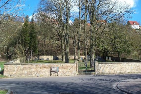
The new cemetery was established in 1908/1912, as the old one had become too small, and was occupied until 1939. Its area covers 5,6 ares or according to other information 6,28 ares.
Medien
Blick auf den neuen Friedhof
Aufnahmedatum
April 2012
Fotografiert von
Michael Ohmsen
c.koehler
Bildquelle (Woher stammt das Bild)
Alemannia Judaica
Breite
1024
Höhe
680
Lizenz
CC-BY-SA
Mimetype
image/jpeg
Rockenhausen: Mazewot of the Jewish cemetery - Grabsteine auf dem jüdischen Friedhof
c.koehler

Quelle
youtube
Video ID
zH-OPAQWMIg
Url
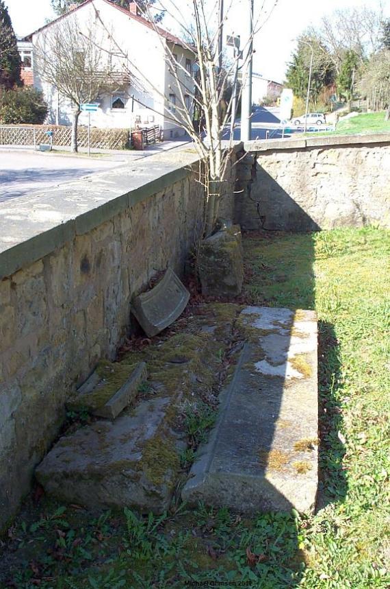
Abbruchfragmente an der Friedhofsmauer
Aufnahmedatum
April 2012
Fotografiert von
Michael Ohmsen
c.koehler
Bildquelle (Woher stammt das Bild)
Alemannia Judaica
Breite
564
Höhe
850
Lizenz
CC-BY-SA
Beschreibung
Whether the fragments are from the synagogue or the cemetery is questionable.
Mimetype
image/jpeg
Literatur
http://www.alemannia-judaica.de/rockenhausen_friedhof.htm (letzter Zugriff am 02.07.18)
http://www.xn--jdische-gemeinden-22b.de/index.php/gemeinden/p-r/1673-rockenhausen-rheinland-pfalz (letzter Zugriff am 02.07.18)
Partner Link
Redaktionell überprüft
Aus
Add new comment