Aufnahmedatum
1801/09
Fotografiert von
o.A.
burukti01
Bildquelle (Woher stammt das Bild)
Wikimedia Commons
ggf. URL
https://upload.wikimedia.org/wikipedia/de/0/0e/Tranchot-Mairie-Efferen.jpg
Breite
1396
Höhe
930
Lizenz
gemeinfrei
Beschreibung
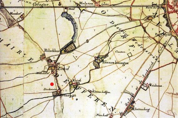
Section from the topographic survey of the Rhineland ("Tranchot map") of 1801/09, here the western environs of Cologne with the farmstead Deckstein in the "Mairie d'Efferen".
Mimetype
image/jpeg