Aufnahmedatum
24.02.2019
Fotografiert von
Johannes Valentin Schwarz
burukti01
Bildquelle (Woher stammt das Bild)
eigene Aufnahme
Breite
3534
Höhe
5302
Lizenz
CC BA-SA 4.0
Beschreibung
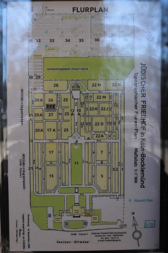
Topographical map at the entrance (as of 2004). The park-like cemetery was laid out axially symmetrically in 1917/18 according to designs by Karl Bing.
Mimetype
image/jpeg