Aufnahmedatum
2006
Fotografiert von
o.A.
burukti01
Bildquelle (Woher stammt das Bild)
Wikimedia Commons
ggf. URL
https://upload.wikimedia.org/wikipedia/commons/c/ca/Kalk_1870.jpg
Breite
670
Höhe
480
Lizenz
gemeinfrei
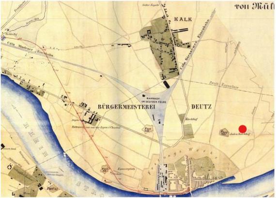
Beschreibung
Map of the "Cöln-Mindener Eisenbahn", 1870. Marked is the "Juden Kirchhof" next to the Deutzer Fort XIV (view to northeast).
Mimetype
image/jpeg