Aufnahmedatum
o.J.
Fotografiert von
o.A.
burukti01
Bildquelle (Woher stammt das Bild)
Wikimedia Commons
ggf. URL
https://upload.wikimedia.org/wikipedia/de/c/c2/Tranchot1807_1808_Judenbüchel.jpg
Breite
680
Höhe
676
Lizenz
Gemeinfrei
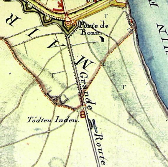
Beschreibung
Section from the Topographical Survey of the Rhineland ("Tranchot Map") of 1807/08. The Bonntor and the area "Todten Juden", south of the boundary of the old Bischofsweg (red) are marked.
Mimetype
image/jpeg