Aufnahmedatum
o.J.
Fotografiert von
o.A.
burukti01
Bildquelle (Woher stammt das Bild)
Pharus-Städte-Atlas, Ausgabe 1912/17
Breite
842
Höhe
560
Lizenz
Gemeinfrei
Beschreibung
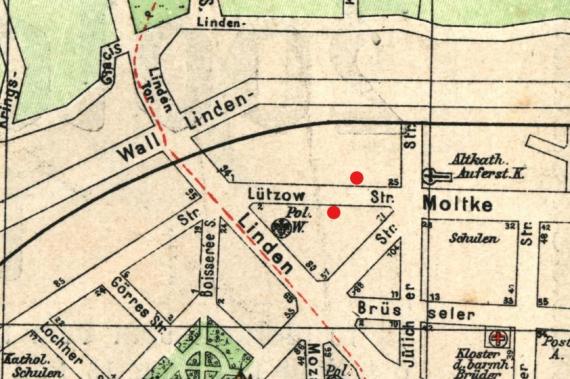
City map of Cologne, 1912 (looking west). The "Israelite Children's Home" (Lützowstraße 35/37) and the later "Municipal Israelite Elementary School" (Lützowstraße 8-10) are marked.
Mimetype
image/jpeg