Aufnahmedatum
o.J.
Fotografiert von
o.A.
burukti01
Bildquelle (Woher stammt das Bild)
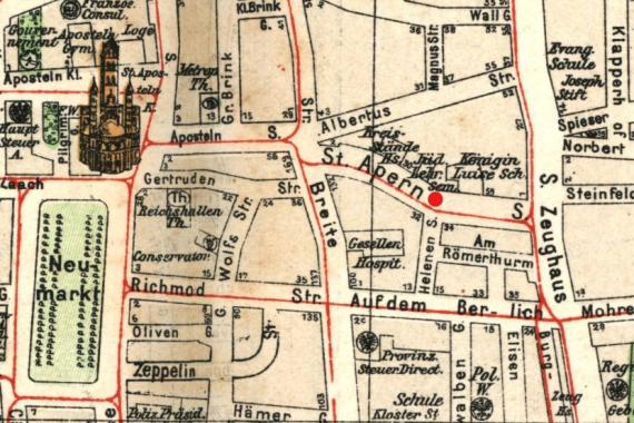
Pharus-Städte-Atlas, Ausgabe 1912/17
Breite
830
Höhe
554
Lizenz
Gemeinfrei
Beschreibung
City map of Cologne, 1912 (looking west). Marked is the teachers' seminary including the synagogue "Adass Jeschurun" in St.-Apern-Straße (1884-1938).
Mimetype
image/jpeg