Aufnahmedatum
o.J.
Fotografiert von
o.A.
burukti01
Bildquelle (Woher stammt das Bild)
Pharus-Städte-Atlas, Ausgabe 1912/17
Breite
749
Höhe
498
Lizenz
Gemeinfrei
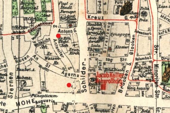
Beschreibung
City map of Cologne, 1912 (looking west). Marked are the department store Leonhard Tietz on Hohe Straße and the house of the Rhineland Lodge on Cäcilienstraße.
Mimetype
image/jpeg