Aufnahmedatum
o.J.
Fotografiert von
o.A.
burukti01
Bildquelle (Woher stammt das Bild)
Pharus-Städte-Atlas, Ausgabe 1912/17
Breite
768
Höhe
512
Lizenz
Gemeinfrei
Beschreibung
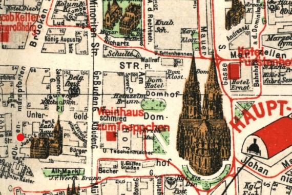
Marked is the Judengasse / corner Obenmarspforten, south of the town hall.
Mimetype
image/jpeg