Aufnahmedatum
Anfang des 13. Jahrhunderts
Fotografiert von
Unbekannt
c.koehler
Bildquelle (Woher stammt das Bild)
Wikimedia Commons
Breite
1208
Höhe
1512
Lizenz
CC0 - Public Domain
Beschreibung
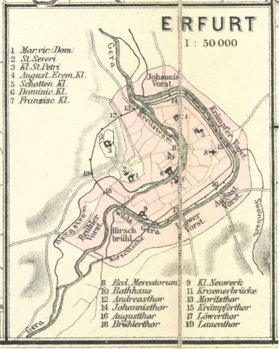
Map of the city of Erfurt at the beginning of the 13th century. The Jewish residential quarters were located east of the town hall (No. 10), the Jewish cemetery at the Moritz Gate (No. 13).
Karl Spruner von Merz / Heinrich Theodor Menke: Hand-Atlas für die Geschichte des Mittelalters und der neueren Zeit, Gotha 31880 (map 39 / secondary map 3; in the public domain), via Wikimedia Commons.
Karl Spruner von Merz / Heinrich Theodor Menke: Hand-Atlas für die Geschichte des Mittelalters und der neueren Zeit, Gotha 31880 (map 39 / secondary map 3; in the public domain), via Wikimedia Commons.
Mimetype
image/jpeg