Aufnahmedatum
um 1650
dst
Bildquelle (Woher stammt das Bild)
Wikimedia Commons
Breite
3176
Höhe
2517
Lizenz
CC0
Beschreibung
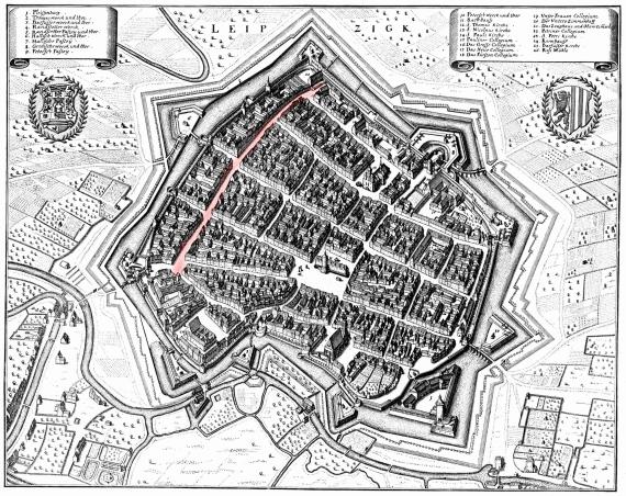
City view of Leipzig around 1650. In the center the market with city hall (No. 11), parallel to the northern city wall the Brühl (marked reddish). The old "Judengasse" was located to the west, in front of the Ranstädter Tor (No. 5).
Mimetype
image/jpeg