Fotografiert von
unbekannt
ANW
Bildquelle (Woher stammt das Bild)
Stadtarchiv Göppingen, mit freundlicher Genehmigung der Arbeitsgemeinschaft „Alemannia Judaica“
Breite
551
Höhe
376
Lizenz
CC-by-SA 4.0
Beschreibung
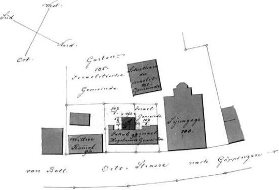
[The site plan of 1886 shows the synagogue on the Ortsstraße (No. 100), diagonally behind it the Jewish schoolhouse (No. 101) with community garden (No. 105). The residential building in front of it (No. 98) was demolished.
Mimetype
image/jpeg
Publikationsdatum Text
1886